A 6.8-magnitude earthquake struck Morocco on Friday night, killing more than 1,000 people and devastating a region where many vulnerable buildings were unable to withstand the shaking.
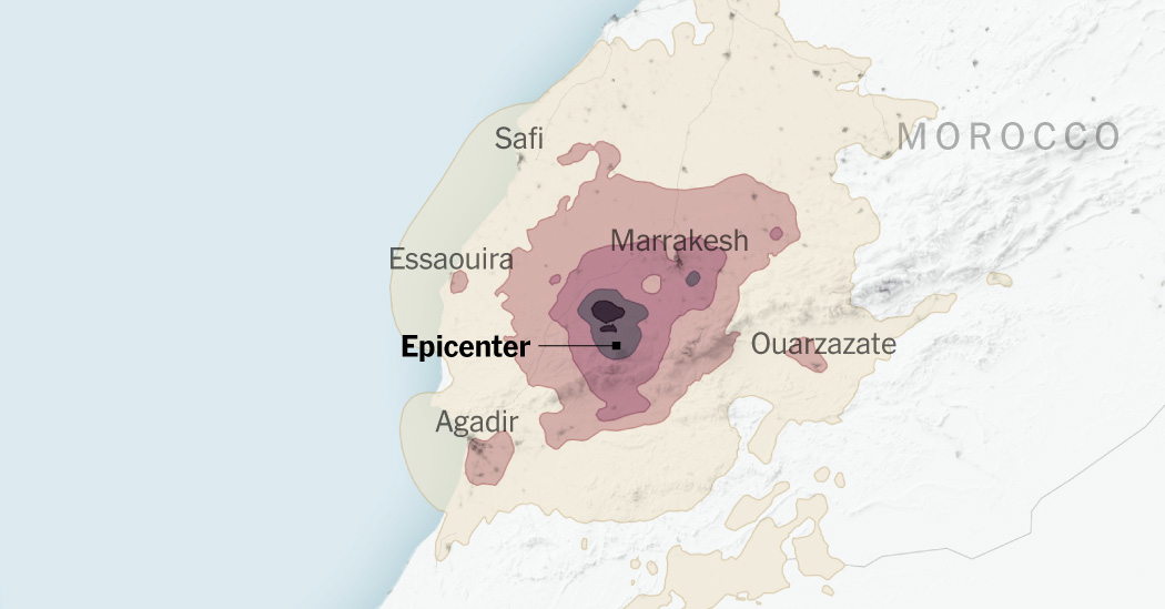
Sources: U.S. Geological Survey; WorldPop
The epicenter was about 35 miles west of Oukaimeden, a popular ski resort in the High Atlas Mountains, according to the United States Geological Survey. Rubble filled alleyways in Marrakesh, a UNESCO World Heritage site, and houses were flattened in villages in the countryside.
Around 1.8 million people live in the area that experienced strong shaking, where the likelihood of damage is highest, according to a New York Times analysis of shake intensity data from the U.S. Geological Survey and population density data from WorldPop. About 3 million more people experienced moderate shaking.
Marrakesh, the largest city in the zone that experienced strong shaking, has one of the country’s most densely populated medinas, ancient mazelike neighborhoods at the center of many Moroccan cities.
The quake caused widespread damage in the city of Marrakesh.
Fadel Senna/Agence France-Presse — Getty Images
Although much of southern Morocco, where the quake struck, is rural, the region’s cities and towns are often very densely populated.


